File:darlingtonmap.jpg
From Asylum Projects
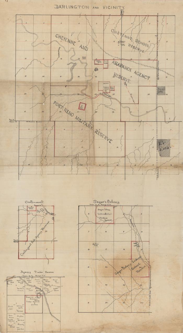
Revision as of 14:07, 10 January 2022 by Jessogrady (talk | contribs) (Hand drawn map of the Darlington Agency and vicinity. Included are The Cheyenne School, The Cheyenne and Arapaho Agency, Fort Reno, the Segar Colony, Cantonment, and the agency timber reserve.)
Size of this preview: 331 × 600 pixels. Other resolutions: 132 × 240 pixels | 700 × 1,268 pixels.
Original file (700 × 1,268 pixels, file size: 101 KB, MIME type: image/jpeg)
Hand drawn map of the Darlington Agency and vicinity. Included are The Cheyenne School, The Cheyenne and Arapaho Agency, Fort Reno, the Segar Colony, Cantonment, and the agency timber reserve.
File history
Click on a date/time to view the file as it appeared at that time.
| Date/Time | Thumbnail | Dimensions | User | Comment | |
|---|---|---|---|---|---|
| current | 14:07, 10 January 2022 | | 700 × 1,268 (101 KB) | Jessogrady (talk | contribs) | Hand drawn map of the Darlington Agency and vicinity. Included are The Cheyenne School, The Cheyenne and Arapaho Agency, Fort Reno, the Segar Colony, Cantonment, and the agency timber reserve. |
- You cannot overwrite this file.
File usage
The following 2 pages link to this file: