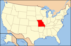
Difference between revisions of "Missouri"
From Asylum Projects
m (→State Hospitals) |
m (→County Institutions) |
||
| (13 intermediate revisions by the same user not shown) | |||
| Line 17: | Line 17: | ||
| Length_mile = 300 | | Length_mile = 300 | ||
| Length_km = 480 | | Length_km = 480 | ||
| − | | total_state_population = 6, | + | | total_state_population = 6,083,672 (2015 est.) |
| total_mh_inpatient_pop = | | total_mh_inpatient_pop = | ||
| year_past_peak_pop = | | year_past_peak_pop = | ||
| Line 40: | Line 40: | ||
* [[Marshall State Hospital]] | * [[Marshall State Hospital]] | ||
* [[Nevada State Hospital]] | * [[Nevada State Hospital]] | ||
| − | |||
* [[St. Joseph State Hospital]] | * [[St. Joseph State Hospital]] | ||
* [[St. Louis State Hospital]] | * [[St. Louis State Hospital]] | ||
| + | * [[Southwest Missouri Psychiatric Rehabilitation Center]] | ||
| + | * [[Western Missouri Mental Health Center]] | ||
== Private Hospitals == | == Private Hospitals == | ||
| − | + | * [[Emmaus Asylum]] | |
| + | * [[Glenwood Sanitarium]] | ||
| + | * [[Ozark Sanitarium]] | ||
| + | * [[Robinson's Neurological Clinic]] | ||
* [[St Vincent's Institution]] | * [[St Vincent's Institution]] | ||
| + | * [[Vaile Sanitarium]] | ||
== State Schools == | == State Schools == | ||
| Line 54: | Line 59: | ||
* [[Missouri State School and Hospital]] | * [[Missouri State School and Hospital]] | ||
* [[St. Louis State School and Hospital]] | * [[St. Louis State School and Hospital]] | ||
| + | |||
| + | ==Reform Schools== | ||
| + | * [[Missouri Reform School for Boys]] | ||
| + | * [[Missouri Reform School for Girls]] | ||
| + | |||
| + | == Federal Government Institutions== | ||
| + | * [[United States Medical Center for Federal Prisoners]] | ||
| + | |||
| + | ==County Institutions== | ||
| + | * [[Barry County Almshouse]] | ||
| + | * [[Buchanan County Infirmary]] | ||
| + | * [[Butler County Poor Farm]] | ||
| + | * [[Cass County Poor Farm]] | ||
| + | * [[Chariton County Poor Farm]] | ||
| + | * [[Dade County Poor Farm]] | ||
| + | * [[Dallas County Poor Farm]] | ||
| + | * [[Gasconade County Poor Farm]] | ||
| + | * [[Greene County Almshouse, MO]] | ||
| + | * [[Jackson County Poor Farm & Asylum]] | ||
| + | * [[Jefferson County Poor Farm, MO]] | ||
| + | * [[Lewis County Poor Farm]] | ||
| + | * [[Malcolm Bliss Psychopathic Hospital]] | ||
| + | * [[Nodaway County Poor Farm]] | ||
| + | * [[Osage County Poorhouse]] | ||
| + | * [[Putnam County Poor Farm]] | ||
| + | * [[Morgan County Poor Farm]] | ||
| + | * [[Pulaski County Poor Farm]] | ||
| + | * [[Putnam County Poor Farm]] | ||
| + | * [[Ray County Poor Farm]] | ||
| + | * [[Saint Clair County Poor Farm]] | ||
| + | * [[St. Louis Chronic Hospital]] | ||
| + | * [[Stoddard County Poor Farm]] | ||
== Sanitariums == | == Sanitariums == | ||
| − | + | * [[Elliott Sanitarium & Hospital]] | |
* [[Emmaus Sanitarium]] | * [[Emmaus Sanitarium]] | ||
* [[Mayfield Sanitarium]] | * [[Mayfield Sanitarium]] | ||
* [[Missouri State Sanatorium]] | * [[Missouri State Sanatorium]] | ||
| − | + | ||
[[Category:United States of America]] | [[Category:United States of America]] | ||
Latest revision as of 17:09, 22 May 2021
Contents
State Hospitals[edit]
- Farmington State Hospital
- Fulton State Hospital
- Marshall State Hospital
- Nevada State Hospital
- St. Joseph State Hospital
- St. Louis State Hospital
- Southwest Missouri Psychiatric Rehabilitation Center
- Western Missouri Mental Health Center
Private Hospitals[edit]
- Emmaus Asylum
- Glenwood Sanitarium
- Ozark Sanitarium
- Robinson's Neurological Clinic
- St Vincent's Institution
- Vaile Sanitarium
State Schools[edit]
- Carrollton State School and Hospital
- Higginsville State School and Hospital
- Missouri State School and Hospital
- St. Louis State School and Hospital
Reform Schools[edit]
Federal Government Institutions[edit]
County Institutions[edit]
- Barry County Almshouse
- Buchanan County Infirmary
- Butler County Poor Farm
- Cass County Poor Farm
- Chariton County Poor Farm
- Dade County Poor Farm
- Dallas County Poor Farm
- Gasconade County Poor Farm
- Greene County Almshouse, MO
- Jackson County Poor Farm & Asylum
- Jefferson County Poor Farm, MO
- Lewis County Poor Farm
- Malcolm Bliss Psychopathic Hospital
- Nodaway County Poor Farm
- Osage County Poorhouse
- Putnam County Poor Farm
- Morgan County Poor Farm
- Pulaski County Poor Farm
- Putnam County Poor Farm
- Ray County Poor Farm
- Saint Clair County Poor Farm
- St. Louis Chronic Hospital
- Stoddard County Poor Farm


