File:Blackwells Map 1879.jpg
From Asylum Projects
No higher resolution available.
Blackwells_Map_1879.jpg (637 × 312 pixels, file size: 81 KB, MIME type: image/jpeg)
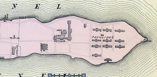
This image is cropped from BLACKWELLS ISLAND from ATLAS OF THE ENTIRE CITY OF NEW YORK : COMPLETE IN ONE VOLUME ; FROM ACTUAL SURVEYS AND OFFICIAL RECORDS" by G.W. Bromley & Co circa 1879. The full atlas can be viewed at [1].
File history
Click on a date/time to view the file as it appeared at that time.
| Date/Time | Thumbnail | Dimensions | User | Comment | |
|---|---|---|---|---|---|
| current | 21:09, 11 September 2011 | | 637 × 312 (81 KB) | Soldat251 (talk | contribs) |
- You cannot overwrite this file.
File usage
The following page links to this file: